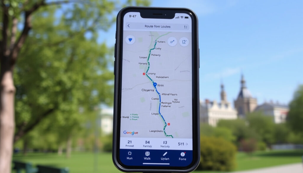
On The Go Map: Free Route Planner for Running, Walking & Cycling
If you’ve ever tried to map out a running route by guessing distances, you know how easy it is to end up miles away from your planned length. On The Go Map solves that with a free web-based tool that snaps to roads and footpaths while showing real-time distance and elevation.
Activities Supported: Run, Walk, Bike · Price: Free · Export Formats: GPX, KML, Embed · Elevation Profile: Yes · Snap to Roads: Yes
Quick snapshot
- Free to use (On The Go Map – official site)
- Calculates distance and elevation (On The Go Map team blog (Medium))
- Exports routes as GPX and KML (OpenStreetMap Wiki (community documentation))
- Whether a dedicated mobile app exists (Chrome Web Store listing (Google))
- Data retention and privacy policy (Chrome Web Store listing (Google))
- Maximum route length (Chrome Web Store listing (Google))
- Offline availability (Chrome Web Store listing (Google))
- Improved elevation profiles released on (On The Go Map team blog (Medium))
- Tool still actively maintained (no recent changelog found) (On The Go Map team blog (Medium))
- Continued use as a free online planner (Made with MapLibre (tech showcase))
- Potential for mobile app updates (unconfirmed) (Made with MapLibre (tech showcase))
The table below summarizes the core specifications of On The Go Map.
| Attribute | Value |
|---|---|
| Platform | Web browser |
| Price | Free |
| Activities | Run, Walk, Bike |
| Export Options | GPX, KML, Embed |
| Elevation Profile | Yes |
| Road Snapping | Yes |
| Account Required | No |
How to Map Your Run, Walk, or Route on On The Go Map
How to create a new route
- Open On The Go Map (official tool website) in any modern browser. No sign-up needed.
- Click on the map to place waypoints. The tool automatically draws a route that follows roads and footpaths.
- Drag any waypoint to adjust the route. The distance updates in real time.
How to snap to roads and footpaths
- Routing uses OpenStreetMap data. When you click, the tool snaps to the nearest road or path.
- For off-road sections (like a trail), switch activity to “Walking” to allow footpath routing.
- The snap feature works for run, walk, bike, and drive activities.
How to view elevation profile
- Click the mountain icon (bottom-left corner) to open the elevation panel.
- The profile shows distance on the x-axis and elevation on the y-axis. Hover over any point to see exact elevation, distance, and grade.
- On The Go Map samples up to 512 points at equal intervals along your route for a detailed gradient curve (On The Go Map team blog).
Runners who need to train on specific gradients can see exactly where each hill is, without paying for a premium app. The 512-point sampling gives a granular view that many paid tools charge for.
The takeaway: On The Go Map turns any browser into a functional route planner with elevation data that rivals desktop software — all for free.
Is On The Go Map Free? How to Download the App
Is the On The Go Map app free?
Yes, On The Go Map is completely free to use. There are no paid tiers, subscriptions, or hidden charges. The official site (tool homepage) states no pricing, and all features — distance, elevation, export — are available without payment.
How to access On The Go Map on mobile
On The Go Map is a web app. You don’t download anything from an app store. Open onthegomap.com in your phone’s browser, and the interface works on both iOS and Android. Some users add it to their home screen as a progressive web app.
What are the limitations of the free version?
Since there is only one version, limitations are minimal. The tool requires an internet connection to load maps and calculate routes. Offline use is not supported. Route length appears unlimited in practice, but the developer hasn’t published a maximum (OpenStreetMap Wiki).
No offline mode means you cannot consult your route on the trail without cellular data. For runners who train in remote areas, downloading a GPX file before heading out is essential.
The trade-off: absolute simplicity and zero cost in exchange for always-on connectivity. For most urban runners that’s a fair deal.
On The Go Map vs. Map My Run: Which Route Planner is Better?
Both tools help you plan a route, but they differ in pricing and feature depth — one is web-only and free, the other is a polished app with social features behind a subscription.
| Feature | On The Go Map | Map My Run |
|---|---|---|
| Price | Free | Free (basic), Premium at $5.99/month |
| Platform | Web browser | iOS, Android, Web |
| Elevation Profile | Yes, 512-point sampling | Yes |
| Road Snapping | Yes | Yes |
| GPX Export | Yes (GPX, KML) | Yes (with Premium) |
| Social Features | No | Yes, community challenges, friends feed |
| Audio Coaching | No | Yes (with Premium) |
Feature comparison: distance, elevation, export
Both calculate distance and show elevation. On The Go Map’s 512-point elevation sampling gives a detailed gradient graph. Map My Run also provides elevation but its free tier hides GPX export behind the premium paywall (Map My Run by Under Armour (fitness platform)).
Pricing: free vs premium
On The Go Map is 100% free. Map My Run’s free tier includes basic routing but restricts advanced data and audio coaching to Premium ($5.99/month or $29.99/year). For runners who only need route creation, On The Go Map wins on cost.
Ease of use: interface and learning curve
On The Go Map’s interface is minimal — you start clicking and the route appears. Map My Run has a richer UI with workout logging and a feed, which can be overwhelming for pure route planning. A Reddit r/AdvancedRunning discussion (runner community) describes On The Go Map as “a really simple website for planning running routes” that snaps to roads and footpaths.
Upsides
- Completely free, no account needed
- Detailed elevation profile with 512-point sampling
- Snap to roads works for run, walk, bike
- Export to GPX and KML
- Embed routes on websites
Downsides
- No dedicated mobile app (web only)
- No offline capability
- No social or community features
- Limited route customization (no manual trail drawing)
- Privacy policy not clearly stated
Steps to Plan a Route in On The Go Map
- Go to onthegomap.com (official site) on any device.
- Select your activity (running, walking, biking, or driving) from the dropdown.
- Click the starting point on the map. A marker appears and the route begins.
- Continue clicking waypoints. The route automatically follows roads/paths.
- Click the mountain icon to view the elevation profile as you build.
- When finished, click “Export” to download as GPX or KML, or click “Share” to copy a link.
- To save, bookmark the page or copy the URL — no account required.
“A really simple website for planning running routes, snaps to roads/footpaths and shows elevation and distance.”
— Reddit user, r/AdvancedRunning (Reddit community discussion)
“The improved elevation-profile feature can be enabled by clicking the mountain icon in the bottom left. Hovering or dragging over the profile reveals elevation, distance, and grade at a point on the route.”
— On The Go Map team (Medium product blog)
For runners looking for a free, no-fuss route planner that delivers detailed gradient data, On The Go Map is a reliable choice. Those who need offline access or social motivation will find Map My Run a better fit, but they’ll pay for it – either with a subscription or by accepting the free tier’s limits. The choice comes down to whether you value simplicity and zero cost over a full training ecosystem.
map-planner.com, us.mapometer.com, routemapper.xyz, reddit.com, racedaylab.com, play.google.com, map-planner.com
For those who prefer a lightweight, no-registration tool, the On The Go Map route planner offers a similar experience with elevation profiles and GPX export.
Frequently asked questions
Can I use On The Go Map offline?
No, On The Go Map requires an internet connection to load maps and calculate routes. Export your route as GPX before heading out if you need offline access.
Does On The Go Map have a mobile app?
There is no dedicated app on iOS or Android. The tool is web-based and works in any mobile browser. Some users add it to their home screen as a progressive web app.
How to save routes on On The Go Map?
You don’t need an account. Simply bookmark the page or copy the URL. The route is stored in the URL parameters and reloads when you revisit the link.
Can I create a round trip route?
Yes, by placing waypoints that return to your starting point. The tool will calculate the total distance and elevation for the loop.
How to change the map style?
On The Go Map uses OpenStreetMap tiles. There is no built-in style switcher, but you can choose different base layers via the layer icon (satellite, terrain, etc.).
Can I import a GPX file into On The Go Map?
No, the tool currently only exports routes. It does not support importing GPX or other route files.
How to delete a route?
Click the “Clear” button or refresh the page. There is no permanent storage, so routes are not saved on the server.
Is there a limit on the number of routes?
Since routes are stored in the browser URL, there is no server-side limit. However, very long routes may result in a very long URL that some browsers or services may truncate.
More related posts
 High Blood Pressure Treatment: Meds, Lifestyle & Quick Relief
 FIFA World Cup 2026 Qualifiers Table: Standings & Schedule
 Where Was Broadchurch Filmed? Filming Locations Guide
 What is 10 Stone in kg? Exact Conversion (63.5 kg)
 Places to Rent Dublin: Platforms, Areas & Tips
 Land for Sale Westmeath: Agricultural & Residential Sites
 Cronos: The New Dawn Review: Is It Worth Playing? (2025)
 T-Shirt Printing Dublin: Costs, Shops & Same-Day Options (2025)
